|
Willem Blaue
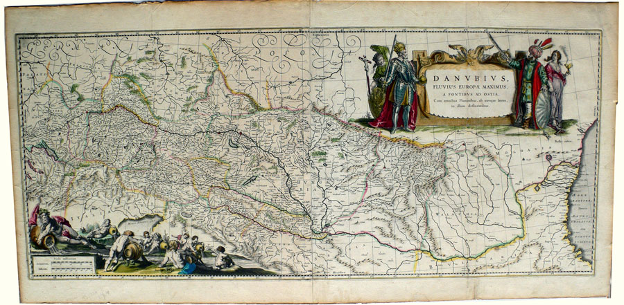
Danubius Fluvius Europae Maximus, a Fontibus ad Ostia..
This beautiful large format map charts the course of Europe's longest river, the Danube. It includes and the surrounding countries from the Danube's source in the Black Forest of southern Germany to its mouth on the Black Sea.
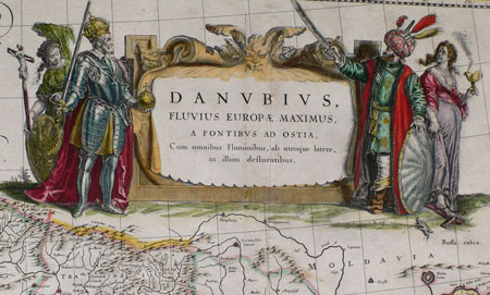
One of Blaeu's largest atlas maps, "Danubius Fluvius Europae" was engraved on two joined sheets. The Cartouche symbolizes two great empires - the Holy Roman Emperor and Europa stand on one side and the Ottoman Sultan and Asia on the other. An extraordinary 17th Century map much of the center of Europe.
Published in Amsterdam, 1635.
Size : 41 x 96 cm.
Contact Village Antiques
for Prices or More Information |