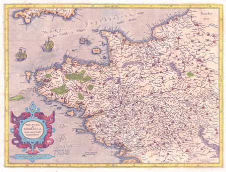
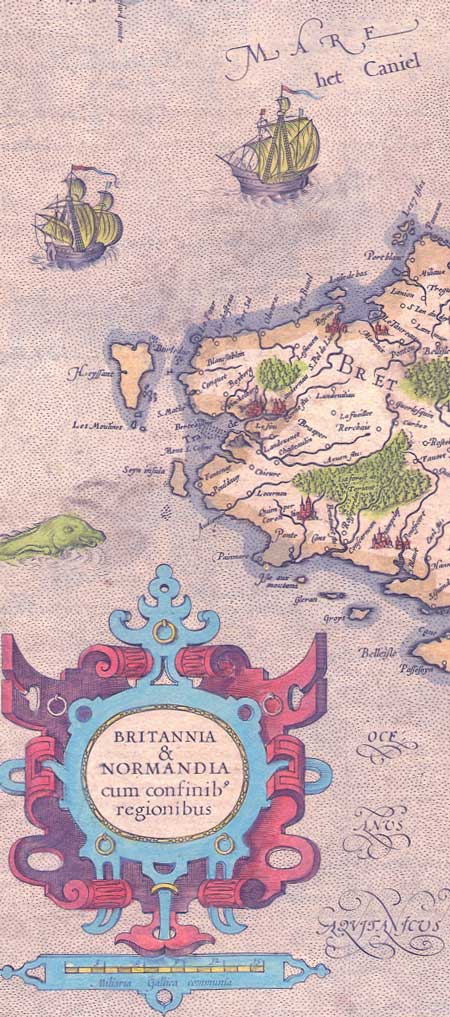
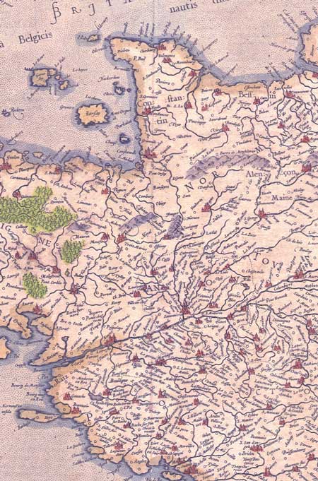
Britannia & Normandia cum Confinibus Regionibus.
Attractive handcolored antique map, copperplate engraving.
Gerard Mercator and Henricus Hondius.
Includes a sea monster and two ships. French text on the reverse.
Conditon: A small tear in the upper margin has been repaired on the back. Some light spotting and discloration.
Engraved Circa 1630.
Size of sheet: Approx 16.5 X 20.5 inches
More antique maps of France |