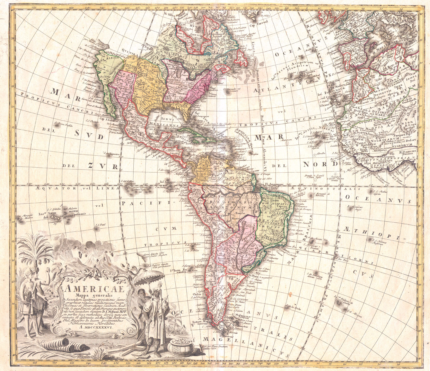
Americae Mappa Generalis
Homann Heirs, 1746
The Western Hemisphere
Copperplate Engraving with full original color.
The coloring delimits the different European possessions on the continent.
California is shown as a peninsula.
In South America, the mythical Lake Xarayes is shown south of the Amazon. The Northwest, which had not yet been explored, is simply left blank.
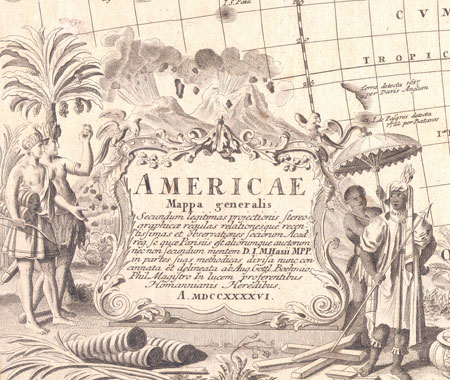
Like many Hohmann maps, this one features a particularly detailed cartouche. It shows two pairs of native Americans, one holding up what appears to be a shrunken head. At their feet are trade goods, and in the background two exploding volcanoes.
Condition: Light overall age browing of the sheet, otherwise very good condition.
Dimensions: 18.5 X 21.23 inches (46 X 53 cm)
Contact Village Antiques
for Prices or More Information |