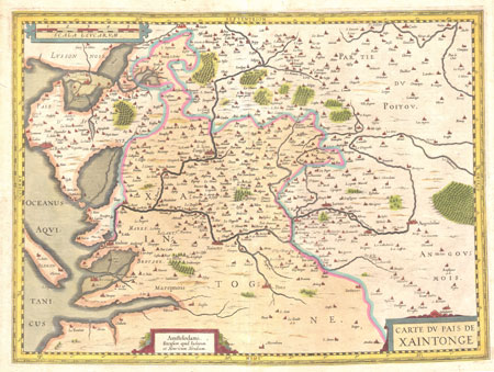
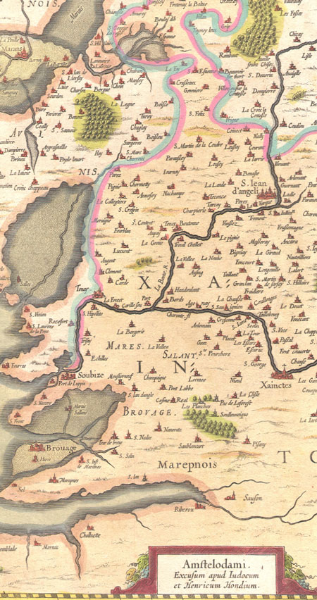
Carte du Pais de Xaintonge
Published in Amsterdam in 1650 by Jodocus II and Henricus HONDIUS (J & H Hondius).
Beautiful copperplate engraved map on old chainlinked paper, handcolored.
Xaintonge or Saintonge is a small region on the Atlantic coast of France within the region of Poitou-Charentes. It's name comes from the ancient Celtic tribe of the Santones who lived in this area, around the current city of Saintes.
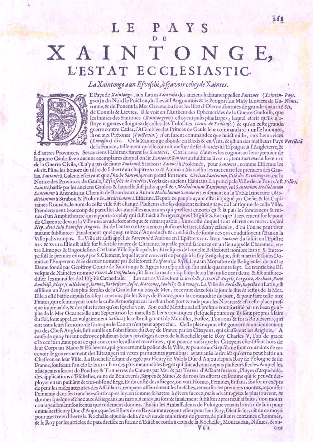
Text on back describes the history of the Le Pays de Xaintonge, beginning with an account of the defeat of the region by Ceasar.
Condition: Overall very attractive condition. Sheet is lightly age toned, with very light soiling. There are a few tears in the margins which do not extend only to the edge of the platemark.
Dimensions: 44x53 cm (17.3x20.9 in)
Contact Village Antiques
for Prices or More Information
Some of the place names on this map:
Saintes
Charentes
La Rochelle
Blaye
Taillebourg
Iarnac
Barbefieux
Marennes
S. Jean dÁngeli
Lorgaire
Poitou
Oleron
La Temblade
Brouage
Porte de Luppin
Rocefort
Pons
Marens
Coullon
Cognac
French Key words: Carte ancienne |