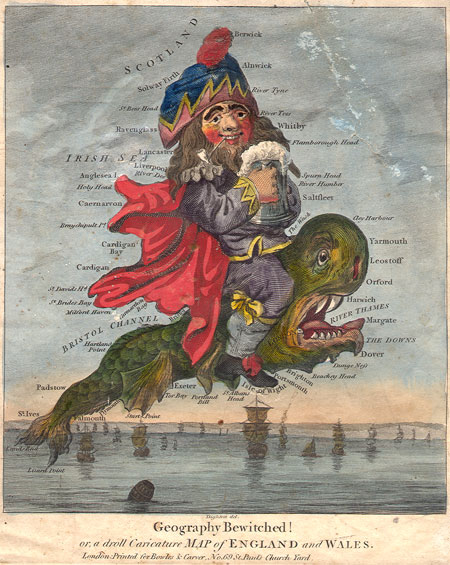
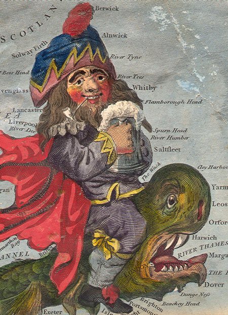
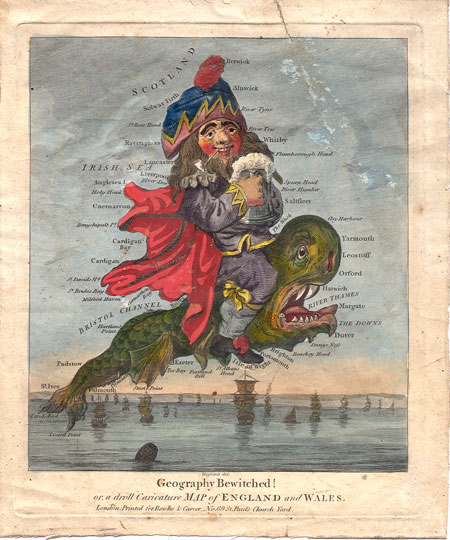
Robert Dighton
Geography Bewitched!
"Geography Bewitched!
or, a droll Caricature MAP of ENGLAND and WALES"
A whimsical of England as a caricature by Robert Dighton, a well-known 18th Century painter of portraits and caricatures.
London Printed for Bowles & Carver, No. 69 St Paul's Church Yard circa 1795.
Locations shown include: Berwick, Alnwick, River Tyne, River Tees, Whitby, Flanborough Head, Spurn Head, River Humber, Saltfleet, Harwich, River Thames, Yarmouth, Leostoff, Oxford, Margate, the Downs, Dover, Cardigan Bay, Bristol Channel, St. Ives, Exeter, Caermarron, etc...
See also:
Lady Hibernia by Robert Dighton
Condition: The sheet is lightly soiled and has been mounted against a second old sheet of paper. A tear in the upper right quadrant has been repaired from behind. The center of the image is striking and the colors are bright.
Dimensions: 8.5 X 10.5 inches
SOLD
|

|