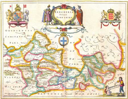
Antique Map of Berkshire
By BLAEU, Willem and Joan
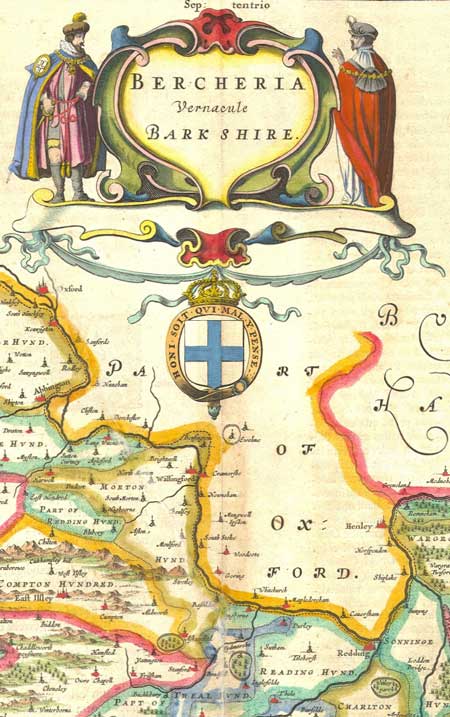
Bercheria Vernacule Barkshire
Published in Amsterdam in 1647
Text in Latin on the verso.
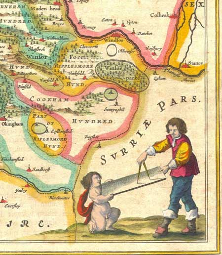
A very decorative handcolored map of the county
of Berkshire, England with figures, a coats
of arms and scutcheons.
Condition: Very good. The map was apparently
torn at one point in its history -- from the
upper left down through the center -- but it
is so expertly reparied that it this is only
noticeable on very close inspection. Some light
discoloration along center fold. Light spotting
in a few areas. Nothing that detracts from the
overall beauty of the map.
Towns and locations which can be seen on this
map include: Farington, Oxford, Abbington, Newberye,
Henley, Redding, East Ilsley, Cumpton, Wantage,
The Vale of Whitehorse, Fairecrosse, Raisnsbury,
Windsor, etc...
Dimensions of Full Sheet: 24 X 21 inches
Dimensions of Map: 19.5 X 15 inches
SOLD