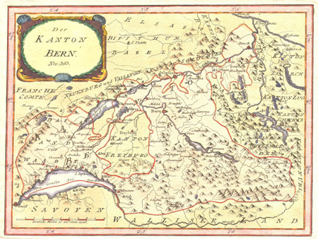
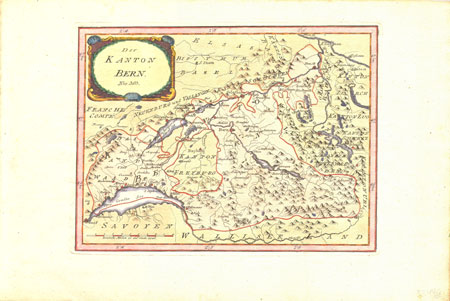
Der Kanton Bern
Franz Johann Josef von Reilly
Very attractively hand colored copper plate
map of the old Canton of Berne, extending from
Lake Geneva almost all the way to Zurich.
A very attractive small map of Switzerland.
Dimensions of the printed surface: around
12 X 9 inches or around 23 X 30 cm
Published in Vienna around 1790 by the Viennese
publisher Franz Johann Joseph von Reilly.
We believe that this map most likely comes
from von Reilly's "Grosser Deutscher
Atlas" the first who world atlas to
be published in Austria.
Regions shown include: Lake Geneva (Genfer
See) Savoy (Savoyen), the Franche Comte, the
Rhone river, Lake Neuchatel, the Murtensee (Lake
Morat), etc...
Towns indicated include: Coppet, Rolle, Moreses,
Cossonay, Aubonne, Geneva, Solothurn, Hermance,
Thonon, Evian, Noseroy, Freiburg, Gruyere, Bern,
Thun, Interlaken, Unterseen, Zofingen.


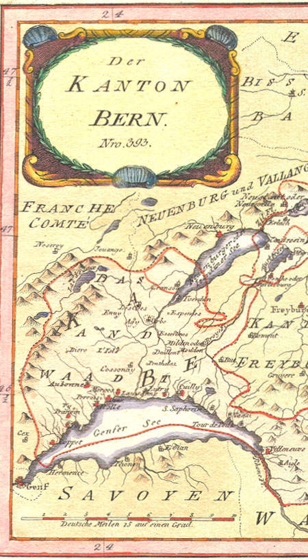
 View of Full Sheet